The Gallatin - Grant Border, 1867
The Kentucky Legislature, on February 27, 1867, according to Chapter 1551 of the Acts of the Kentucky Legislature took part of Grant and gave it to Gallatin. That part is essentially a triangle that runs southwest, from Munk to Elliston. This act gives everything between that line and the present day border, to Gallatin. Generally, going northwest, it makes the boundary Eagle Creek until you get to Ten Mile, then Bullock-pen, and then to the Boone County line.
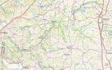
These two maps give you a vague idea of where we're talking about:
Here's a much more detailed map (click to enlarge):
Here's what the act said:
"That portion of the county of Grant beginning at the dividing line between the counties of Grant and Gallatin, on Big Eagle Creek, and running with the meanders of said creek to where Ten Mile creek empties into the same, and from the mouth of Ten Mile creek, with the meanders thereof, to where the said creek is crossed by the Boone county line; or if the source thereof does not reach the Boone county line, then to follow the meanders of said Ten Mile creek to where Bullock-pen creek empties into the same, and with the meanders of said Bullock-pen creek to where the said creek is crossed by the said Boone county line; and thence from where the said Ten Mile or Bullock-pen creek is crossed by the said Boone county line, with the said line, to the dividing line between the counties of Gallatin and Grant; and thence with the said dividing line to the beginning of Eagle creek."
However:
On February 26, 1868 - 364 days later - another act was passed, reversing the above act, and the area reverted back to Grant County.
Why did they go thru this? We have no idea.
Why do the Maps from an 1889 Kentucky Agricultural Yearbook - the ones at the top of the “Links & Miscellany” pages - show map features 20+ years out of date? We again have no idea.


