|
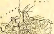
This is the map from the expedition of Captain Charles Lemoyne de Longueil map. We put the yellow dot on it so you can easily locate what will be Cincinnati. Note down around Big Bone, where it notes "Endroit -- our` on a` trouve' des os d'Elephant en 1729". In English, that's “Place where one found the bones of Elephant in 1729.” This is the map that put Big Bone, well, on the map, and made it famous throughout the world. Not America; the world. The map is dated 1729, was published in 1744, and many - not all - believe it was actually from 1739, not 1729. |
Cherokee “cessions” of portions of Northern Kentucky. Details.
Maps of Northern Kentucky start with this one, John Filson's (Wikipedia), from 1784
 |
 |
| 1789 Map by Jedidiah Morse | 1790 from a Facebook post by Owen Findsen |
 |
 |
 |
 |
| Jefferson | Woodford | Scott | Mason |
| At the time of Kentucky statehood - 1792 - Northern Kentucky consisted of these four Virginia counties. | |||
 |
| Portion of a map by Elihu Barker, reduced by W. Barker Sculp, 1794-95 |
 |
||
| Portion of a map from 1797 by Gilbert Imlay |
“State of Kentucky from the best of authorities” 1800, John Scoles, engraver |
from Payne's Geography, 1800 |
 |
 |
| NKY Views is grateful to Frankfort tavern owner Philip Bush (“bed and bedding in the best order”) in 1802 for published, for the convenience of his customers, a list of stage routes leaving Frankfort. The two above go thru Northern Kentucky, and into the N.W.T. (Northwest Territory. Ohio in 1802 is still not a state). How old is stuff from 1802? | |
from Carey's American Atlas, 1806
 |
 |
 |
| by S. Lewis, 1804 | 1812 map by John Melish | by Lucas Fielding, 1817 |
 |
 |
 |
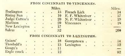
| These three remarkable lists are the mileage charts, from 1819, for overland routes from Cincinnati to points south. In an era when river transportation ruled, railroads were non-existent in North America, canal prospects were exciting, and roads could be glorified paths, it's fascinating stuff. Where are all these places? Our thoughts, research, and speculations are here. 1819!! from The Cincinnati Directory, by Deming, E. Hall, Harvey. Farnsworth, Oliver. Robinson & Fairbank (Cincinnati, Ohio) Published 1819 | ||
The Kentucky Legislature authorized a road from Frankfort to the Ohio River at Gallatin in 1814.
The Kentucky Legislature authorized a “waggon-road” from Frankfort to Cincinnati in 1792
 |
 |
 |
 |
| by Luke Munsell, 1818 key |
Northern Kentucky, 1825 |
1827 | excerpt from The Limestone Road, by Victor Collot, 1826 |
1827 Map from Bullock, as below
 |
 |
|
| from Sketch of a Journey Through the Western States of North America, W. Bullock, 1827 | ||
 |
 |
| Lexington to Cincinnati | Frankfort to Cincinnati |
| from Mitchell's Traveller's Guide to the United States, 1838 | |
 |
 |
|
| Ensign's Travel Guide and Map of the US, 1845, which had an insert |
 |
 |
|
from an 1862 map of Kentucky |
1862 Section of a Map of the Army of the Cumberland |
1863 Lloyd's Map of Kentucky |
 |
| The Union Army commissioned this one, 1865 |
| In 1866, the L&N Railroad published a booklet which contained a map of the various surveys made for possible rail routes from Louisville to Cincinnati. The map (pdf) is here. If you really want to read the whole booklet - all 56 pages of it, it's here. Both are pdf's. |
 |
 |
| John Bartholomew, 1867 | Mendenhall, 1867 |
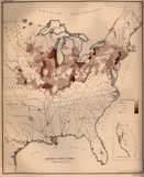
Citizens of German descent, from the 1870 Census
 |
 |
|
from Colton & Co., 1882 |
1882 Richmond and Louisville |
1883 Consolidated Southern Railway Map |
![]()
Very detailed Sanborn Fire Maps of most Northern Kentucky towns, and D.J. Lake Atlas' of
virtually every town in Northern Kentucky from the late 1880's. Details on both are here.
![]()
 |
 |
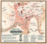 |
1891 Kentucky Railroad Commissioner's Map |
1896 Boone's Black Diamond Railroad Map | 1898 |
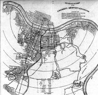
The Kentucky Post published this map of the street car system, and also ran a feature story about it, in 1894.
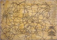
1899 bicycle route map of the bluegrass
Mendenhall's New Map of Cincinnati, c. 1900
With Streetcar Routes
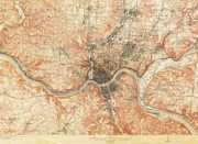
1912 Topographical map
 |
 |
| 1913 Map showing proposed railroad line | Portion of a 1913 Rand McNally map showing streetcar lines. (Trivia: It's one of the very few maps to ever show the Ludlow Lagoon's islands.) |
In 1914, the Louisville Auto Club offered helpful routes to get from Louisville to Maysville, to Cincinnati via Georgetown, to Cincinnati via Carrollton (and Indiana), and to Carrollton. |
portion of Mendenhall's Railroad Map of Ohio, 1918
Note the Brooksville Railroad
![]()
In October of 1926, the Cincinnati Auto Club suggests this route from Cincinnati, through Kenton, Boone, Grant (“not ten acres of level ground in the county”), Pendleton, Campbell and back to Cincinnati. |
Map showing “Automobile Roads”
A map of the various Northern Kentucky Ohio River Ferries
from the Facebook page of the Behringer-Crawford Museum
A. C. Wagner Map, c. 1925
 |
 |
| Northern Kentucky, 1923 |
Northern Kentucky Highway Map, 1929 Key to the above map |
We recommend the map of all the old Northern Kentucky Trolley lines at this site.
A mess. 1930
Rivers and Creeks in Boone, Kenton, and Campbell
 |
 |
 |
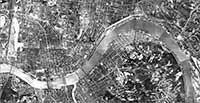
| 1932 Aerial | Rural Mail Routes in Kenton and Boone, 1948 |
Map of Ferry Routes From a Facebook post by the Behringer-Crawford Museum |
Dr. Paul Tenkotte wrote about the development of I-75 at this site.
![]()
 |
 |
 |
| The US Geological Survey Published these glacial maps in 1949. | ||
Remember when the Licking River flowed north to Hamilton, Ohio, and the Kentucky River turned northeast at Carrollton and headed for Cincinnati? No? That’s because you were born after the last glacier left the area. Read all about it, here. |
Here's a description of where the glaciers came in Boone, Kenton, and Campbell.
And here is one geologist's take on the northern end of the old Kentucky River.
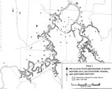
| A glaciation map from the doctoral dissertation of James Tobias Teller, at the University of Cincinnati in 1970. You can find his 131-page dissertation, Early Pleistocene Glaciation and Drainage in Southwestern Ohio, Southeastern Indiana, and Northern Kentucky, online. |
![]()
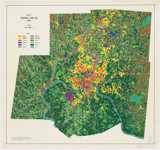
1975 Land Use map
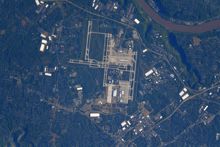
A more contemporary aerial photo, whose scale kinda renders it as a map. North is to the right
 |
 |
| Not maps, but aerial photo's from astronaut and space station commander Shane Kimbrough (Wikipedia), of CVG and Northern Kentucky. June, 2021. | |
unknown year
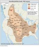
Supposedly where the buffalo roamed, and when.
![]()
Chicago's Newberry Library has posted online a complete set of maps of American counties formations. They start with the date of county formation, and trace every little change to the boundaries after that. To see the counties from which the county was formed, you'll have to download the entire Kentucky state pdf. There's also a feature that you can use to import all this data into Google maps. Good stuff! |
|
| Dr. Paul Tenkotte writes on the creation of I-71 and I-75 at this site. | Another site that has some dynamic overlays of Kentucky Counties and their formations, since 1790. The site is here. |
| Highways north from Frankfort and Georgetown, north to the Ohio, through Owen, Carroll, and Gallatin, are detailed in this 1836 Act of the Legislature. | |
US 27 was established 1928, more here. But a road from Newport to Falmouth to Cynthiana was created much earlier. Say 1818. |
Contemporary maps of all Kentucky Counties can be seen here. |
| The O. F. Stone Baking Company of Cincinnati, published a map of Kenton County for Centennial Week in 1914. It's here. | Kenton County Library has a nice collection of Northern Kentucky maps here. |
| For THE really great site for maps of Kentucky and everywhere else, we highly recommend the Mother of All Map Sites, the David Rumsey collection. Check it out here: http://www.davidrumsey.com/ | Last and not at all least is Old Maps Online. It covers the entire country, but there's some great stuff here. |
US 27
![]()


