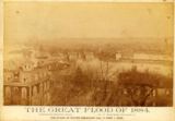
and earlier . . .
1882 Flood description.
| “A great calamity has overtaken this city. After passing through a protracted siege of smallpox, we find at least one-third of our city submerged by the prevailing flood and about 3,000 families suffering and destitute. We need help. It is only necessary to announce this fact to the citizens of our common county to obtain relief. Please send relief to W. H. Lape, Treasurer of the Citizens' Relief Fund, Newport, Ky., or to the undersigned. William H. Harton, Mayor.” Cincinnati Enquirer, February 21, 1883 |
More on the 1883 Flood

Indianapolis Journal, February 14, 1883
An 1883 flood note, as it were.
Details on the 1884 flood in Newport.
“Newport, Kentucky, reports 3,387 houses inundated, the estimated damage being $1,000.000. Thirty-three buildings were washed away, and 127 turned bottom upward.” uncredited news clipping regarding the 1884 flood in Newport |
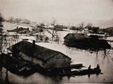 |
| 1884 Newport Flood |
1884 Flood description.
Another 1884 Newport flood story.
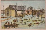 |
 |
 |
| Flood of 1884, the Ohio side of the Newport bridge |
Flood of 1884, Bellevue & Columbia Streets |
Flood of 1884, foot of Fifth Street |
It's estimated that some 2100 homes were under water in Newport in the 1884 flood.
1884 was the second worst flood, after 1937, in Newport history.
Read more about it in the stories of February 8,
February 12,
February 14,
and February 19.
1884, from the Courier-Journal, here.
![]()
Brief note on the floods in 1901.
![]()
| “At 10 o'clock to-night all the cellars on Arabella street, Newport, from Southgate to Fourth street, were full of water and many residents were preparing to move out. The Licking River has inundated the Queen City Jockey Club property at Wilders station, the track being almost covered with water. Water in the pits at the Lick rolling mill has caused a shut-down and 250 hands will be idle.” San Francisco Call, Volume 81, Number 86, 24 February 1897 |
![]()
 |
 |
 |
 |
| Somewhere in Newport in the 1907 Flood |
Looking North on the Licking Notice the old Licking River Bridge |
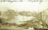
4th and Brighton, 1907 | 2nd and York, Newport, 1907. Note Wiedemann's Beer Sign |
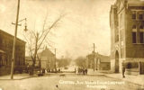
Central Avenue, looking north from Chestnut.
That's the old Immaculate Conception School on the right.
from the Facebook page of Old Photos of Newport
 |
 |
 |
From
Columbia, looking West on Fourth, Newport, 1907
right, “Etta, This is the one I am
on. See if you can find me. Phil”
| |
 |
 |
 |
| 1907 Newport Flood Scene |
1907 Newport Flood Scene |
“Jerry's Place”, on the Licking note the earlier Licking River Bridge in the background |
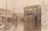
1907 Flood, 5th & Isabella |
 |
 |
 |
| Concrete Houses on Isabella Street, 1907 |
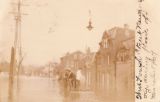
Taken March 17, 1907 | West Fourth, Flood of 1907 |
East Front Street, from Central Bridge
on the back of the card, the author tells us his numbers mean:
1. The Old Taylor Mansion;
2. Capt. Horn[?] Home (he died a few months ago);
3. Barlow's Old Corner;
4. York St. leading to river;
5. Foot of York, Old Ferry Landing;
6. The Old Justis Place

Newport from the Central Bridge.
The back says the water is at 60.6 feet, but doesn't say if it's 1907 or 1913
A brief note on the 1862 flood in Newport.
![]()
