 |
 |
 |
| On Prospect, looking south, toward 11th |
North from Sixth & Main, Covington |
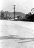
What is now Route 8, in West Covington, 1930 |
At the corner of the Mother of God Cemetery
1859 Covington
from the 1859 Williams Directory of Cincinnati
Temperance Hall at Scott and Market Place dedicated in 1854.
Philadelphia Street sinks 15 feet as 1937 flood recedes, here.
Highland Avenue
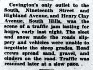
Cincinnati Enquirer, January 23, 1937
 |
|
 |
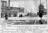 |
| Madison & 17th | Pike at the railroad |
| The story that ran with these two pictures. | |
| Although there had been issues at least 20 years earlier | |
 |
 |
 |
 |
| Covington Traffic Patterns, 1930 |
Extension of 19th between Madison and Scott |
Re-routing Southern Avenue near Decoursey in Latonia |
Extension of Scott to Madison |
| The traffic flow diagram, and the three route change proposals here are all from the same
1930 Strategic Plan mentioned above. You can read the whole plan at Google Books. |
|||

|
“Purchase of eight traffic lights, to be installed in the near future at Fourth, Fifth, Seventh, and Eleventh Street intersections with Scott Street; Sterrett and Madison Avenue; Pike & Holman Streets; Fifth and Madison; and Ritte's Corner in Latonia was determined upon by Covington City Commissions, meeting in conference recently. Commissioners decided to install six traffic lights as a preliminary step toward a complete traffic system in Covington.” from Motour: The Magazine of the Cincinnati Automobile Club, May, 1928. |

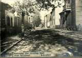 |
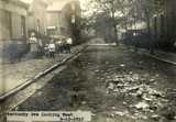 |
| Kentucky Avenue, looking East from railroad | Kentucky Avenue, looking west |
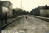 |
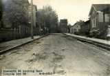 |
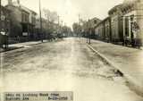
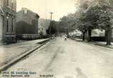
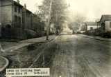
| 11th, east from Short Main | 11th, E. toward Lee |
 |
 |
 |
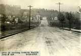
| 16th, looking w. from Eastern | 16th, looking e. from Eastern | 16th, looking e. toward Ella1 |
| 1. Ella Street was renamed Oakland, we think. It was one block east of what is now Eastern. Maps. | ||
 |
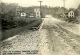 |
| 16th, looking toward Euclid | 16th, looking toward Jefferson, from Euclid |
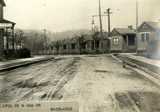 |
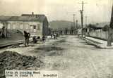 |
| 16th and May | 16th, looking w. from St. Clair |
 |
 |
 |
| Court Street, from Park | Looking south on Philadelphia, 1975 from Facebook post by Marty Cahill, |
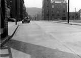
Scott looking north from 3rd |
5th and Scott in the 1937 Flood
 |
 |
| Looking West on 4th From a Facebook post by James Russell |
Fourth & Scott, c. 1910 |
 |
 |
 |
| Fourth Street, West of Madison, Covington |
South from 8th & Greenup |
15th and Russell, Covington |
 |
 |
 |
| Lawyers Building, 1922 Third and Scott |
Scott Street dead ends at Sterritt, 1930 |
Scott at Second, c. 1950 |
![]()
| “The Covington Journal says ‘A little son of Jimmy Withers, seeing a horse attached to a wagon rushing down Scott street, between Fourth and Fifth Thursday, threatening to destroy everything in his way, ran out in the street, and, at considerable peril to himself, leaped into the wagon from behind and checked the animal. The boy is only twelve years old and deserves great credit for the feat.’” Courier-Journal, June 23, 1873 |
![]()
| Scott, looking north from Fourth, c. 1900 | Court Street, c.1900 | Court, South from Fourth, c. 1900 | Court, North from Fourth c. 1900 |
John C. Meyer, 626 Scott, sells three Reo Speed Wagons
5 / 3611
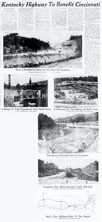
Cincinnati Enquirer, July 12, 1959
Construction of that portion of I-75 that would come to be known as “Death Hill.”
By 1984, Northern Kentucky had had enough of Death Hill, and the Governor announces change.

Cincinnati Commercial, July 28, 1871

Cincinnati Daily Gazette, September 30, 1869
On a section of Garrard that no longer exists, c. 1936.
This map may be helpful
From a Facebook post by Linda Schilling Mitchell
 |
 |
| Scott, South from 17th, Covington, 1905 |
Scott, South of Robins, Covington, 1905 |
Quality Corner, 4th and Scott, Covington
to Mrs. Elizabeth Grunow, FRD 9, Jackson, Mich, c/o Mrs. A. D. Palmer.
Dear Sister, Dear old Ky is some town we just came over on the old bridge,
it is the grand old site of your life. well be home soon, sister Evelyn
Bank Lick Pike authorized, 1839.
 |
 |
| 1316 Greenup | |
| From a Facebook post by Charlie Hammock | From a Facebook post by Chris Brooks |
 |
 |
 |
 |
| Beautiful Residences Greenup Street |
Greenup, South from 13th |
Section of Greenup Street, 1903 |
Greenup at the River |
| It's obvious in the above right image that Greenup lines up with Cincinnati's Walnut Street (and Covington's Scott Street lines up perfectly with Cincinnati's Vine Street), so how is it that the Suspension Bridge doesn't line up with either??? Find out here. | |||
A few tourist shots, entering Covington on US 25 & US 42

| “Covington, Ky., is on the lower side of the Licking river, built on a fine plain mostly above the highest floods of the Ohio. A steam-ferry unites it with Cincinnati, and a suspension-bridge is about to be built across the Licking connecting it with Newport. The streets are laid out so as to appear, from high ground, like a continuation of the city of Cincinnati on the opposite bank of the river. It contains a fine city-hall, several churches, printing-offices, a Baptist theological college, a cotton and silk factory, tobacco-factories, ropewalks, etc. Pop. about 12,000. ” from Appleton's Southern and Western Travellers' Guide, 1849 | |
| They're selling lots in Austin's subdivision in 1853. | Scott Street's historic Boone Block to be torn down, here. |
| Covington moves one of its tollgates on the Lexington Pike, 1903. | |
| “The suit against the property-holders in Covington, on Ninth street, between Madison and Washington, to enforce the payment of a special tax levied to pay for the paving of that square with locust blocks, was decided at the late term of the Chancery Court there, against the property-holders.” Courier-Journal, December 19, 1871 | |
| “Mr. Charles Trantwein at one time a saloon-keeper on Madison street, and at present residing on the corner of Seventh and Craig, has met with a loss of nearly all his movable furniture and his wife, who went off together last Saturday night. The woman was Mr. Trantwein's second wife, and he threatens to shoot any one who brings her back while he offers a liberal reward for the recovery of the furniture.” from Covington's The Ticket, November 2, 1875. | |


