
. . . and a few earlier.
Flood of 1847
 |
 |
 |
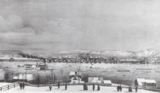
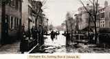
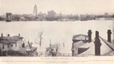
| Covington from the Suspension Bridge in the 1884 Flood |
Covington looking at the Suspension Bridge 1884 Flood |
Second and Greenup, 1884 |
![]()
In 1884, there were 350 houses underwater in Covington and 6,000 people homeless.
More on the 1884 flood in Covington, here and here.
![]()
 |
 |
|
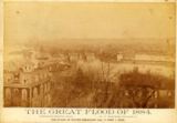
| 1884 Flood | ||
 |
 |
 |
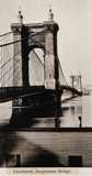
| Here's the Cincinnati end of the Suspension Bridge in the 1884 Flood | Collage of Cincinnati and NKY Scenes in 1884 Flood | |
 |
 |
 |
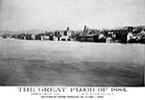
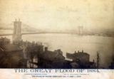
| All three of these are from Covington, toward Newport, in 1884. Treat them as one long, panoramic view. You can pick out Newport Barracks, and a glimpse of the older Licking River Bridge (extreme right). Our guess is they're taken from atop Booth Hospital. | ||
![]()
A very few words on the flood in 1901.
![]()
 |
 |
 |
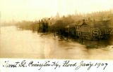
January, 1907 |
Views of 3rd Street, Covington, 1907 |
|
 |
 |
 |
|
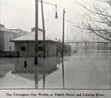
| Towards Newport | West from the C&O | Gas Works | |
 |
 |
 |
|
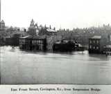
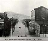
| East Front Street | West Third | Lewisburg |
The above six images are all from the 1907 flood.
 |
 |
||
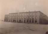
Front Street, Covington, 1907 |
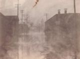
Greenup Ave. looking west from the bridge, 1907 from a Facebook post by Dale Ashcraft |
 |
 |
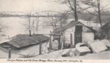
Droege's Rolling Mill in |
13th Street in the Flood, |
![]()
 |
 |
 |
| Good stuff. These three are identical locations, but obviously taken in different years. Since the card on the right is pre-printed as 1913, we're betting the one in the center is 1907. We know the one on the far left is 1883. left photo from a Facebook post by Kevin Hericks | ||
 |
 |
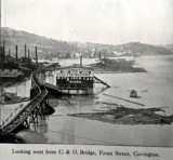
| East from the C&O Bridge, | Front Street, |
These two are 1907? 1913? 1937? |
|
![]()

On Main Street, 1913
From a Facebook post by Marcia Schrader
 |
 |
 |
 |
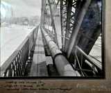
The Licking River Bridge |
Pattison Brothers Kentucky |
1913 Flood, Covington | Looking North, 1913 |
 |
 |
 |
 |
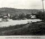
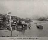
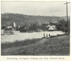
Lewisburg in the 1913 Flood |
Austinburg in the 1913 Flood |
High Water in 1913 |
April 4, 1913 |
![]()
|
"What on earth does all these calamities mean anyway. Floods, winds and hailstorms, Earthquakes, Titanic Disaster, wars in both countries, tidal waves, perilous and hard times everywhere? Well, please read the 24th chapter of Matthew and Mark, 13th Ch. And Luke 21t Ch. And James, 5th Ch. And the third Ch of 2 Tim. And many other passages and you will see that it is all to remind us that the coming of the Lord is very near at hand, this generation if you please, sure!"Message from the back of a flood postcard, dated 1913, to Mrs. Stella Kraus, 1026 Everett Avenue, Louisville, Ky. |
 |
 |
 |
| Fourth Street Bridge Between Covington and Newport, 1913 (Although, we've also seen card on right dated as from the 1907 flood) |
||
 |
 |
 |
Fourth Street Bridge Between |
View from the 11th Street |
Covington, 1913 Flood |
![]()
1933 Flood
From a Facebook post by Pam North
 |
1933 Flood
The 1933 Flood was the 10th worst in Cincinnati History, cresting at 63.6 feet.
![]()