 |
 |
 |
 |
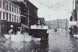
| Maysville in the 1913 Flood |
Front Street in the 1913 Flood |
Third Street, by the L & N Depot |
Somewhere in Maysville, 1913 Flood |
 |
 |
 |
 |
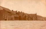
| Flood Damage, 1913 | Front Street in the 1913 Flood |
Second Street in the 1913 Flood |
Back of the St. Charles Hotel (it faced Front St.) |
 |
 |
 |
 |
| Second and Poplar | Home of A. C. Spahr, owner of Maysville Brickyard |
Second and Sutton | C & O Freight Station, Clooney and Second |
 |
 |
 |
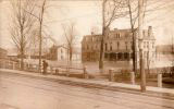 |
| Second and Wall Street | Residences on East Second Street |
Second and Limestone |
C & O Depot |
 |
 |
 |
 |
| West Second, looking east to Wall |
Front Street | Plow Factory on E. Second |
East Second Street, Maysville |
 |
 |
 |
 |
| Chansler Drug Store | Second Street in the 1913 Flood | Second Street East from Prospect | Commerce Street, Maysville |
 |
 |
 |
 |
| An old baseball stadium? | West Second Street | Flat Cars at the L & N Depot | Second Street |
 |
 |
 |
| West Second Street | Walnut Street Garage | Wall and Second Street |
 |
 |
 |
 |
| Chanseler's Drug Store |
The Cochran House | Back of the Mason Lumber Company |
Second and Limestone |
 |
 |
 |
 |
| Market and Front | Second and Commerce That's the W. B. Mathews Lumber Co in background |
The C & O Passenger Station |
From the top of the First National Bank |
 |
 |
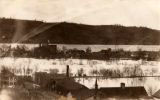
| Looking northwest in the 1913 Flood That's the L & N Railroad |
East Second Street |
Idiots driving thru flood waters in a car is not a new phenomenon.
 |
 |
 |
 |
| Unidentified 1913 Flood pics | |||
 |
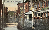 |
 |
| Market Street, 1913 | West Second Street | East Street, 1913 |
| The coverage of the 1913 flood in Maysville from the Lexington Leader: | ||
| March 29, 1913 | March 31, 1913 | Another March 31, 1913 |
Another view of the 1913 flood in Maysville.
Yet another view of the 1913 flood.
The 1913 flood crested on March 31, at 68.4 feet, and is estimated to have been eight and a half to ten inches higher than the previous record of 1884. 1937 would add 7 feet to that record, cresting on January 27th, at 75.4 feet. |
![]()
Go to our Rivers Page for more on Historic Ohio River Highs, Lows, and Floods
![]()


