
 |
 |
 |
||
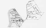
| Trimble formed from Gallatin, 1837. | Trimble loses area to creation of Carroll, 1838. | Trimble gains area with Henry, 1843. | ||
| Boundary changes in Trimble County since it's inception. In addition to those shown, there were two lesser changes involving unique property owners: in 1842 with Oldham, and in 1850 with Henry. | ||||
 |
 |
 |
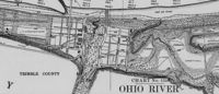
| Trimble County, 1889 red line is a proposed railroad |
Trimble County, 1935 red lines are roads, black lines are railroads |
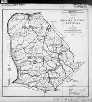
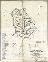
Trimble County, 1940 a map of magisterial districts |
![]()
 |
 |
 |
|
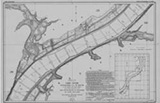
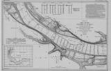
| Patton's Creek | Bethlehem, Ind. | Corn Creek | |
 |
 |
 |
|
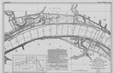
| Spring Creek | Cooper's Bar | Milton | |
 |
|||
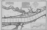
| Hunter's Bottom | |||
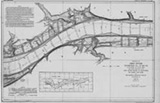
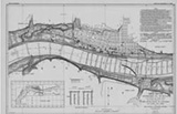
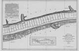
| In 1911-1914 the Corps of Engineers mapped the entire length of the Ohio River. You can see the whole thing, from Pittsburg to Cairo, at their web site. Clicking the maps shown here will take you to the appropriate Trimble County map at the Corps' site. | |||
Close Up of Milton from the 1911 maps
![]()
 |
 |
 |
|
| 1900 Census | 1920 Census | 1930 Census |
 |
 |
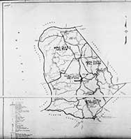
| Maps that defined census districts. left, 1940; right, a 1942 map used for the 1950 census | |
![]()
 |
 |
 |
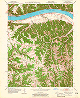
| Mt. Byrd (1953) | Milton (1953) | Eastern Tip (1953) |
 |
 |
 |
| Wise's Landing (1953) | Bedford (1953) | Providence (1952) |
 |
||
| Southern Tip (1961) | ||

Geologic Structures, 1978
![]()
 |
| Robert Rennick drew this map showing locations of where, over time, there have been post offices in Trimble County. |
![]()