
![]()
 |
 |
 |
 |
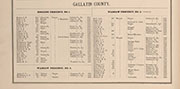
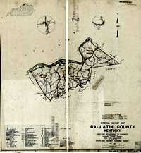
| Gallatin was formed from Woodford on December 14, 1798. | Portion lost to Owen County; part lost to Boone County, 1820. | Portions of Owen County lost; parts of Boone County lost. 1828. | Parts of Boone County added, 1837. |
 |
 |
 |
 |
| Trimble County formed, March 1, 1837 | Carroll County formed, March 1, 1838 | Corner of Grant added, 1867. | Corner of Grant lost, 1868; Sanders sent to Carroll, 1872. |
![]()
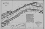
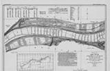
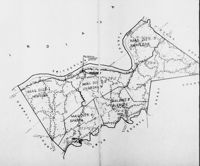
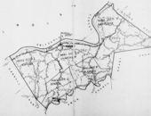
| Philadelphia's D. J. Lake Company put out atlases for hundred of counties in the US in the 1870's and 1880's. These are the Gallatin pages from their Atlas of Carroll and Gallatin Counties, 1883. |
 |
 |
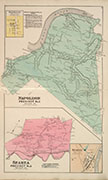 |
| Glencoe | Hoggins Precinct | Napoleon-Sparta |
 |
 |
|
| Warsaw | Warsaw Precinct | Patrons |

![]()
 |
 |
 |
| Big Bone Creek | Patriot, Ind. | Sugar Creek |
 |
 |
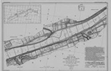 |
| Warsaw | Etheridge | East Ghent |
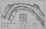
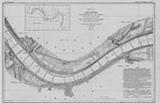
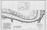
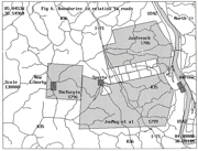
| In 1911-1914 the Corps of Engineers mapped the entire length of the Ohio River. You can see the whole thing, from Pittsburg to Cairo, at their web site. Clicking the maps shown here will take you to the appropriate Gallatin County map at the Corps' site. | ||
![]()
 |
 |
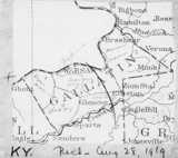
| Gallatin County, Kentucky, 1889 (red lines are proposed railroads) (Why does the southeast corner look wrong? Here.) |
Gallatin County, Kentucky, 1935 Red Lines are roads, black lines are railroads |
 |
 |
 |
 |
| Census Districts, from the 1950 Census. | Magisterial District Map from 1940 | Census Tract map for 1920 Census | This is a map outlining the 1950 census tracts, based on a 1942 map. Note the inset circles. |
![]()
| Here's a complete set of Gallatin County 7.5 minute topographical maps, from the years indicated. | |||
 |
 |
 |
 |
| Northwestern Tip (1957) | Warsaw (1951) | Steels Bottom (1951) | Concord |
 |
 |
 |
|
| Southwestern Tip (1952) | Sanders (1951) | Glencoe (1950) | |
![]()
 |
 |
We know these thumbnails don't look like much but click on them and be impressed. These detailed 1910 maps of east and west Warsaw are Sanborn Fire Maps, originally created to assist insurance companies assess risk for underwriting fire insurance, hence “fire maps.” The Library of Congress' site for Sanborns is in the process of scanning all of them - in full color. Not all have been scanned as of this writing (August, 2020), but the Library's intent is to eventually bring them online. Stay tuned. Eventually, they should have Sanborns for 1910 and 1927 of Warsaw. |
 |
 |
| Gallatin County, 1931 Note that it shows locations of one-room schools |
Robert Rennick drew this map of the locations of many of the communities that had, at one time, post offices. |
 |
 |
|
| Dr. Carl Bogardus drew the map on the left, with numbered locations explained by the key on the right. | ||
 |
 |
 |
| Very early Gallatin land grants. | This map of Gallatin County is from 1923 (Pre-U.S.42) Note several roads no longer exist. |
They announce a new Interstate Highway in 1963. Map above (with a Sanders exit) and the story is here. |
![]()