 |
 |
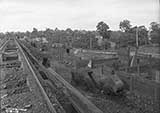
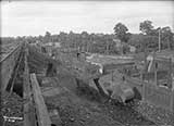
| Bracht depot. Technically, it's in Kenton County, but it seems to belong here too. | |
 |
 |
 |
 |
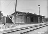
| Crittenden Depot, June 5, 1915 | Crittenden Depot | ||
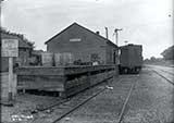
Sherman, 1911
![]()
“The depot at Sherman has closed, and the business of the company
abandoned. All freight shipped to this point is at the risk of the owner.”
from the Williamstown Courier, December 1, 1892
![]()
 |
 |
 |
 |
| Dry Ridge Depot, 1911 and 1914 | |||
 |
 |
| Dry Ridge Depot, 1920 | Southern Railroad Depot, |
 |
 |
 |
 |
| Williamstown Depot | |||
 |
 |
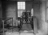 |
| Pump House at the Williamstown depot. Note Lake Obispo in the background. | ||

Evening Star (Washington DC), October 17, 1876
 |
 |
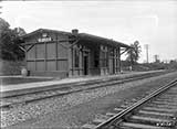 |
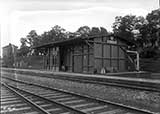
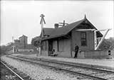
| Mason Depot, June 21, 1915 | ||
 |
 |
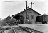
Blanchett Depot, September 6, 1911 |
|
Water for Blanchett Depot?
Blanchett
Fatal train wreck at Blanchett, 1895
 |
 |
 |
| 1911 | 1909 | 1915 |
Corinth |
||
Corinth
![]()
“A riot occurred between white and negro laborers on the Southern Railroad in Grant County, Kentucky, yesterday. Reports state that two negroes were killed and eight wounded. None of the whites were injured.” Daily Alta California, June 17, 1875 More about this incident here and here. |
| “Williamstown Sentinel says: The track layers have reached a point a half mile south of Roberts' store. A few more days and the locomotive will echo its shrill notes within the limits of Williamstown.”Courier-Journal, July 29, 1876 |
| “Williamstown, Grant county, has heard the whistle of a locomotive on the C. S. road [Cincinnati Southern Railroad], and is happy.”Courier-Journal, August 28, 1876 |
| “The scream of the locomotive whistle has waked Williamstown from her Rip Van Winkle sleep, and the Sentinel says trade is now brisk.”Courier-Journal, September 9, 1876 |
| “Williamstown, Grant County, established telegraphic communication with the outside world Thursday” Courier-Journal, September 16, 1876 |
![]()
 |
 |
 |
 |
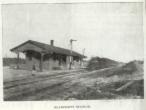
| Sherman | Blanchett | Crittenden | Williamstown |
| The Williamstown Courier in 1901 ran a special historical edition which contained the above four depot images. | |||
![]()
The City of Cincinnati built the railroad in Grant County. After the Civil War, Cincinnati merchants wanted urgently to be able to sell goods in the south, but could not match prices from Louisville merchants. Louisville simply had to put things on the L&N, and ship. Cincinnati merchants had to load cargo on a steamer, ship it to Louisville, unload it, and then load it on the L&N. Transportation costs gave Louisville a price break in the South. Long story short: Cincinnati built a railroad; the CNO&TP, a.k.a., The Cincinnati, New Orleans, and Texas Pacific, a.k.a., The Southern. Ohio law said the city couldn't buy stock in a railroad, but it didn't say they couldn't build one. The political battle in Kentucky was fierce. The Courier-Journal didn't exactly feel sorry for Cincinnati. They editorialized “Grass will certainly not grow in the streets of Cincinnati in our day. The merchants of Cincinnati, the railroad men of Cincinnati, are a thoroughly live and ingenious set of Yankee plotters, who propose to swarm upon the Southern country like ducks upon June bugs.” Counties not served by the L&N in Kentucky felt differently, so the Kentucky authorities eventually relented, and various lengths of the railroad, offering a variety of passenger and freight services opened from 1887 to 1880. Originally the C. N. O & T. P., it eventually became the Southern Railway. In 1881, Cincinnati leased it's holdings to an English corporation controlled by German-born Parisian banker Frédéric Émile d'Erlanger (Wikipedia). The city of Erlanger is named for him. d'Erlanger's CNO&TP holdings eventually end up, in 1894, joining a number of railroads under the name Southern Railway. |
![]()
 |
Station | Ludlow | Chattanooga |
| Walton | 17.6 | 317.4 | |
| Bracht | 21.0 | 314.0 | |
| Crittenden | 24.5 | 310.6 | |
| Sherman | 27.6 | 307.5 | |
| Dry Ridge | 31.6 | 303.5 | |
| Most of the Grant County depots had a sign, like the enlargement shown here, showing the mileage between Ludlow - the start of the CNO&TP, and it's end point, Chattanooga. The chart here summarizes the numbers on the signs. | Williamstown | 35.1 | 299.9 |
| Mason | 39.5 | 295.5 | |
| Blanchet | 43.7 | 291.4 | |
| Corinth | 45.7 | 289.4 |
 |
 |
|
| WS Tower, Williamstown | WS Tower, Williamstown | |
| These are interlocking towers on the Southern Railway. What's an interlocking tower? Wikipedia knows. WS is just the code name the railroad gave this particular tower. | ||
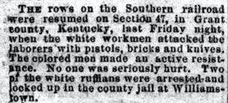
The Star (Cincinnati), July 6, 1875
Williamstown Crossing, 1913
Williamstown, it says.
![]()

