
 |
 |
|
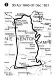
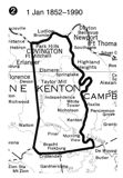
| The original boundaries when the county was established, 1840 | A corner is lost to Grant County, 1852 | |
| Adjustments in the county line since the county was formed; only one change makes Kenton unusual; most counties have several. Not mapped is a small change to accommodate a private property owner in 1866. | ||
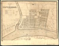
Covington, c. 1850
 |
 |
Covington, 1835 |
Covington, 1860 |
 |
 |
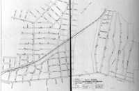
| Mostly Boone, but some Kenton in this 1866 Railroad Map. You'll want the key to what all those red lines are. It's here. |
Covington, 1883 |

| Cruiz Creek Railroad Bridge This is an excerpt of a Civil War map showing block houses built by the US to defend the railroad bridges of the Kentucky Central for being destroyed by the Confederacy. The entire map consists of insets of most of the towns from Benton (the town of Kenton) to Lexington, and is on the NKYViews Map Page. |
![]()
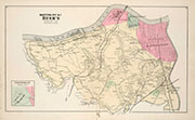
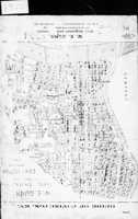
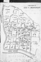
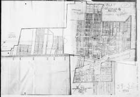
| Philadelphia's D. J. Lake Company put out atlases for hundred of counties in the US in the 1870's and 1880's. These are the Kenton pages from their Atlas of Boone, Kenton and Campbell of 1883. |  |
|
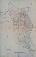
| Precincts overview | ||
 |
 |
 |
 |
| Central Covington | Main Covington | Independence | Koch's Precinct |
 |
 |
 |
 |
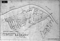
| Ludlow | Rush's Precinct | Scott's Precinct | South Covington |
 |
 |
 |
 |
| Stephenson's Precinct | West Covington | Patrons, Part 1 | Patrons, Part 2 |
![]()
|
|
 |
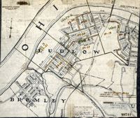
| Ludlow / West Covington, 1884 |
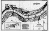
Covington, 1884 (the dashed line is a "Horse Railway Line") |
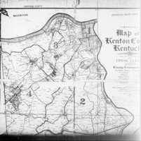
Kenton County, 1889 |


![]()
 |
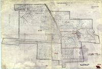
| This exceptionally detailed map of a small portion of Covington is from 1886 is a Sanborn Fire Map. They were originally created to assist insurance companies to assess risk for underwriting fire insurance, hence “fire maps.” We've downloaded this single page from the Library of Congress' site for Sanborns. This map is one of ninety-seven (97!) in the Covington-Newport set from 1886. You can download them all in incredible detail. Check back from time to time at their site, to see if they digitize the later sets from 1906 and 1909. Those later sets are available now, in black and white, at the Kenton County Library's site. |
![]()
 |
 |
| Bromley | C0vington / Ludlow |
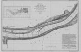
| In 1911-1914 the Corps of Engineers mapped the entire length of the Ohio River. You can see the whole thing, from Pittsburg to Cairo, at their web site. Clicking the maps shown here will take you to the appropriate Kenton County map at the Corps' site. | |
 |
 |
 |
| Topographic Map of Northern Kenton County, 1914 |
This hand-drawn map is by Edith Claire George, who drew it in 1923 to go with her history of Covington and Kenton County. Read it here. (pdf) |
Kenton Map, 1923 |
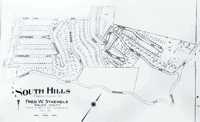
South Hills, 1927
 |
 |
 |
Kenton County, 1935 |
Kenton County, 1935 |
Covington, 1938. Note there's a key to selected attractions. |
 |
 |
 |
|
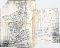
| Elsmere 1937 | Northern Kenton, 1930, with some interesting road proposals | Structural Map, 1931 |
![]()
| The US Census Bureau divides its task areas up into tracts, and delineates those tracts on maps. Presented here is a partial set of Kenton County maps for the years indicated: |
 |
 |
 |
 |
| 1900 from an 1890 map | 1900 Census | 1903 map for the 1910 census | 1914 map |
 |
 |
 |
 |
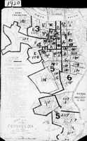
| 1920 census tracts | 1914 map for the 1930 census | 1930 census | 1937 map for 1940 census |
 |
| Erlanger, 1930 census tracts |
 |
 |
 |
 |
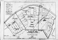
| 1927 map for 1920 census [!] | 1927 map for 1930 census | 1937 Ludlow Map for 1940 Census | 1949 Ludlow Map for 1950 Census |
 |
 |
| Elsmere Map for 1940 Census | 1949 Elsmere Map for 1950 Census |
 |
 |
| 1948 Fort Mitchell Map for 1950 Census | 1948 Covington Map for 1950 Census |
![]()
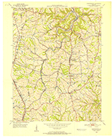
| A set of 7.5 topographic maps of Kenton County from the 1950's: | |
 |
 |
| Covington (1950) | Latonia (1952) |
 |
 |
| Independence (1950) | Visalia (1953) |
 |
 |
| Piner (1950) | Morning View (1953) |
![]()
 |
 |
 |
| Kentonvale | What would become Edgewood, c. 1930, (Not to Scale) From a Facebook post by Bridget Grady Spears |
Ryland, 1946 From a Facebook post by Robert Remley |
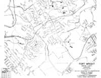
Fort Wright, 1973
 |
 |
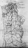
| Robert Rennick drew this map of the locations of a number of places in Kenton County which had post offices at one time or another |
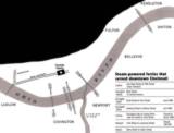
A map of the various Northern Kentucky Ohio River Ferries from the Facebook page of the Behringer-Crawford Museum |
 |
 |
| Fort Mitchell / Crescent Springs, 1937 |
Erlanger / Elsmere, 1937 |

| Not a map, but a photo from astronaut Shane Kimbrough (Wikipedia), of Northern Kentucky. June, 2021. |
![]()