
 |
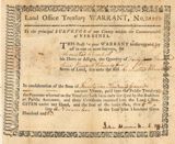 |
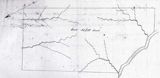
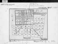
| December 29, 1783, Armistead Churchill bought a land warrant for 40,375 acres in Mason County; 11,415 of which are in the surveyed plat above. The metes and bounds of the survey are here. | |
 |
 |
 |
||
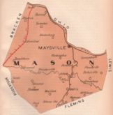
| Mason County, as formed, 1789, by the Commonwealth of Virginia, from Bourbon County, VA. | Mason lost area when Campbell was created, 1795. | Mason lost area when Bracken was created, 1797. | ||
 |
 |
 |
||
| Mason lost area when Fleming was created, 1798. | Mason lost area when Floyd and Nicholas were created, 1800. | Mason lost area when Greenup was created, 1804. | ||
 |
 |
|||
| Mason lost area when Lewis was created, 1806. | Mason lost area when Robertson was created, 1867. | |||
| Since Mason was created so early, most of it's county boundary changes are due to shrinkage by the formation of new counties. In addition to those changes mapped above, there have been minor boundary changes to accommodate unique land owners in 1854 (with Bracken), 1868 (with Robertson), 1888 (with Fleming), and 1890 (with Lewis). | ||||

From Limestone toward Frankfort, 1796.
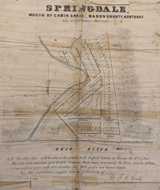
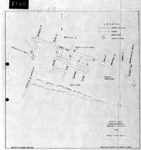
Springdale Plat
| Our source says this is c. 1800, but we suspect that's too early. The seller of the lots, one J. C. Gould of 30 East Fourth Street in Cincinnati we find running ads in the 1840's. On the plat, note Major Rodgers home, built in 1794. |

The National Road
A source of significant controversy (Wikipedia).
A part of the controversy? Slavery
An argument for the road
 |
 |
 |
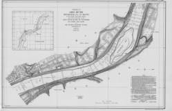
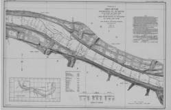
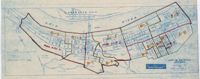
| Dover | Charleston | Charleston Bottom |
 |
 |
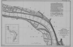 |
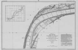
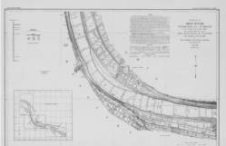
| West Maysville | East Maysville | Springfield |
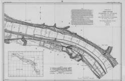
| In 1911-1914 the Corps of Engineers mapped the entire length of the Ohio River. You can see the whole thing, from Pittsburg to Cairo, at their web site. Clicking the maps shown here will take you to the appropriate Mason County map at the Corps' site. | ||
 |
 |
 |
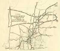
| Mason County, 1889 red lines are proposed railroads |
Mason County, 1935 red lines are roads, black lines are railroads |
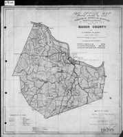
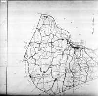
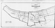
1940 Map of Magisterial Districts |
![]()
Each decennial census is broken into districts. These are the maps the Census folks used to define those census tracts.
 |
 |
 |
||
| 1910 Census Map | 1903 Map for 1920 Census | 1925 Map for 1930 Census |
 |
 |
|
| 1940 Census Map | 1948 Map for 1950 Census *Note inset maps* |
 |
 |
|
| Germantown, 1925 map for the 1930 census | Germantown, for the 1940 census |
 |
|
| Maysville, 1915 map for 1920 |
 |
 |
|
| Eastland District of Maysville, 1938 for 1940 | Maysville, 1940 |
![]()

Robert Rennick drew this map locating many of the places that had post offices at one time or another.
![]()
Maps in this section are from An Illustrated
Atlas of Mason County, Kentucky, published
by Lake, Griffing
and Stevenson in Philadelphia, 1876.
 |
 |
 |
| Helena | Fern Leaf Precinct | Germantown Precinct |

 |
 |
 |
| Orangeburg Precinct, town map, and business listing, 1876 | ||
 |
 |
 |
| Murphysville Precinct, town map, and business listing, 1876 | ||
 |
 |
 |
 |
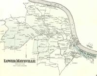
| Lower Maysville Precinct | Upper Maysville Precinct | Maysville Wards | East of Maysville |
 |
 |
 |
 |
 |
| First Ward | 2nd & 3rd Wards | Fourth Ward | Fifth Ward | |

Maysville and Dover
 |
 |
 |
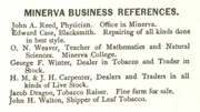 |
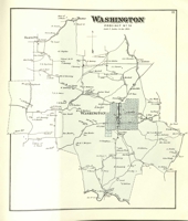
| Washington Precinct | Washington | Minerva | Minerva Business Listing, 1876 |
 |
 |
 |
 |
| Mays Lick | Mayslick businesses, 1876 | Lewisburg | Lewisburg business listing, 1876 |
 |
 |
 |
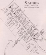
| Sardis Precinct, town map, and business listing, 1876 | ||
 |
 |
| Dover town map and business listing, and precinct map, 1876 | |

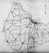
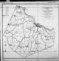
Mason County, c. 1880
![]()
 |
 |
Maysville, 1940
![]()
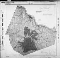
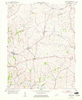
| This section is a set of 7.5 topographical maps covering all of Mason County from the 1950's. | ||
 |
 |
|
| Dover (1952) | Very small tip (1961) | |
 |
 |
 |
| Germantown (1952) | Maysville West (1952) | Maysville East (1952) |
 |
 |
 |
| Sardis (1952) | Mayslick (1952) | Orangeburg (1952) |
 |
 |
 |
| Southwestern tip | Helena (1952) | Southeastern tip (1951) |
![]()
 |
| This exceptionally detailed map of Maysville from 1886 is a Sanborn Fire Map, originally created to assist insurance companies to assess risk for underwriting fire insurance, hence “fire maps.” We've downloaded this single page from the Library of Congress' site for Sanborns. This map is one of nine in the set from 1886. They also have a set from 1890 (13 maps) and a set from 1895 (15 maps). |
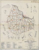
Highway 68, “the historic highway,” here.
![]()