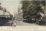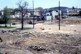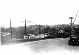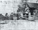
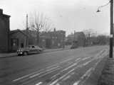
Eighth Street, East from Central, 1907
![]()
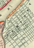
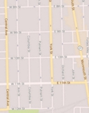
1890 - The year Newport re-named it's streets
Newport extended it's city limits by these streets in 1868.
And in 1869 by these streets.
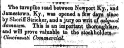
The Catholic Telegraph, April 5, 1856. (Jamestown, a.k.a. Jimtown, was an early name for Dayton)
The bridge from Newport to Dayton, then Jamestown, was authorized in 1795.
![]()
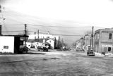 |
| Looking north on Saratoga, 1946. A copyrighted image from the Chesapeake and Ohio Railroad Society, and used here with their kind permission. |
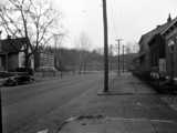 |
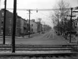 |
|
| North and South on Washington, 1946. A copyrighted image from the Chesapeake and Ohio Railroad Society, and used here with their kind permission. |
||
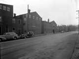 |
 |
| Looking west on 11th, 1946. A copyrighted image from the Chesapeake and Ohio Railroad Society, and used here with their kind permission. |
|
Damage in Newport from the 1915
Tornado
Images include:
1. Wiedemann's Baseball Field, 2. Grace Methodist Church
3. Clifton School ( larger image here), 4. Clifton
5. The L&N Bridge (notice things floating)
 |
 |
| Looking East on Fifth | Marching South on Monmouth |
![]()
 |
 |
 |
In 1930, the Northern Kentucky Automobile Club and the Newport Auto Dealers
Sponsored Safety Week, with Brake Tests. These three pictures are from
that event.
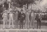
These are the sponsoring dealers. Who are they? Here.
![]()
C. N. & C Streetcar lines, 1914-1934
from Terry Lehmann's and Earl W. Clark's The Green Line. Recommended.
Before the Levee. Note bridge at left.
From a Facebook post by
Sam Routzon
Edward T. Hurley drew this Newport Scene
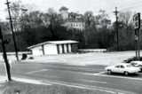
A closed Exxon gas station, at Monmouth and Carothers. Note Mt. St. Martins.
From a Facebook post by Doug Ollier
Before I-471, that's 10th and Grand, with the streetcar going up to
Fort Thomas on what you know as Memorial Parkway.
Grand's going downhill; Waterworks going uphill.
Harvey's Coal is the business, later a hardware store.
From a Facebook post by Tom Taylor
 |
 |
| The Blue Line | The Green Line |
The July, 1926 issue of Hail Columbia, the house publication of the gas &
electric company,
ran these two pictures and this
article (pdf) about one man's career on the streetcars.
The man that made a boat out of Green Line streetcar.
| In the trolley years, the Kenton County cars went into the second floor of Dixie Terminal, in a ramp directly off the Suspension Bridge, while the Newport cars came into the first floor, off Cincinnati's Third Street. At its peak, 156 street cars or buses per hour would come though the terminal in rush hour. |
| Dr. Paul Tenkotte wrote about the Dixie Terminal at this site. |
![]()
 |
 |
In 2011, the City of Newport published this handy historical tour brochure.
I-471 Construction, 1978
from a Facebook post by Bill Theis
![]()
| “Newport, Ky., is opposite Cincinnati, on the upper side of the Lacking[sic] river. It contains a U. S. garrison, several churches, a seminary, private schools, a rolling-mill, cotton-factory, etc. Pop. about 3,500. A steam-ferry connects it with Cincinnati, the boats plying every few minutes during the day.”Appleton's Southern and Western Travelers' Guide, 1849 |
| Sharp's pool room manager, an “ex-Virginia gentleman” shows his patrons “how they did Negroes in Virginia.” |
| “From the Covington Journal. Our sister city of Newport with a population of some 15,000 souls, hasn't a regular hotel within its borders. What is lacking in this respect , however, is more than made up by the number of beer saloons.” as reprinted in the Courier-Journal, May 13, 1868 |
| “Newport, Ky., is briefly described as a town of 30,000 inhabitants, without a single bookstore, where boys of 5 or 6 years puff cigars with an experienced air on every corner.” Indianapolis News, September 12, 1881 |
| When Admiral Dewey took Manila Bay (Wikipedia) in 1898, there was an attempt to re-name Isabella Street Dewey Avenue, which, obviously failed. |
| Newport declared most densely populated city in Kentucky in 1920. |
| “Matt Cooper, of Newport, got to rehearsing some of his foul-mouthed obscenity last night, and officers Burke and Haggemann very sensibly locked him up. He is a nuisance that decent men have to submit to because he is a drunken no account brute. The privileges he is allowed only encourage him in his actions; and when he is fined and doesn't pay he should go to the stone pile as many another better man has had to do.” from Covington's The Ticket, November 23, 1875. |
The last tollgate in Kentucky was on Alexandria Pike in Newport.
The story of it's demise is here.
If you read about the “Buena Vista” section of Newport, this is it. The boundaries of what's called Buena Vista have expanded over the years, but these are the official original boundaries: 8th, Monmouth, 12th and Central. |
Lots for sale, 1850.
![]()
