
 |
 |
 |
 |
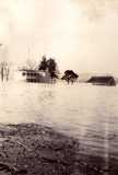
| Webb Hotel | [unlabeled] | Indiana Hills | 2nd Street: Mrs. Sallie McCann's corner |
 |
 |
 |
 |
| Baptist Church Hill | Mrs. Tandy's Corner | Airport, looking North | Mrs. Bowie's Residence (Dr. Threlkeld's) |
 |
 |
 |
 |
| Water on Sparta Pike | Harry Beall's Residence | Near furniture factory | |
 |
 |
 |
 |
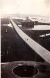
| River over highway at airport, looking S.W. | Airport - Plane about to land | Showing Florence Kentucky, Across River | In front of Court House |
 |
 |
 |
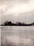 |
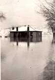
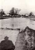
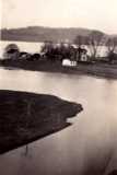
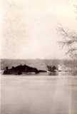
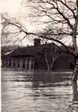
| Mrs. Bowie's Residence / Dr. Threlkeld's | Bledsoe Home opposite Florence, Ind. | Old brick building near ferry | Highway Covered At Harvey Beall's Above Town |
 |
 |
 |
 |
| Looking Towards Warsaw - from Airport | Emerson Allen's | Old brick building near [!] river ferry boat anchored at landing | View of Warsaw from the Water Tower |
 |
 |
 |
 |
| Looking towards Warsaw from Airport | View of Warsaw from the water tower, looking West | View of Warsaw from Water Tower, looking N. W. | Bledsoe Farm |
 |
 |
 |
|
| Webb Hotel | Looking down the river from Airport | Bell's Farm Above Town | |
 |
 |
 |
 |
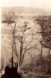
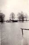
| Riverfront, Warsaw | Water Across Lane Leading to Dean Richard's Home (Old Gibson Farm) | Near Indian Mounds Bayou - South of Warsaw | Webb Hotel |
 |
 |
 |
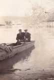 |
| Riverfront in Warsaw | Old brick building near ferry landing | Coast Guard Boats at Mrs. McCann's corner | Joe Eddie Miller and Louis Hall |
 |
 |
 |
 |
| Bledsoe Farm | Baptist Church corner | In front of court house. W. R. Payne in foreground | Old picture show building, Craig property |
 |
 |
 |
 |
| Water over highway at Beall Farm Above Warsaw | East of Warsaw, water over highway, Beall's farm | Looking Towards Warsaw from Airport | View of Warsaw looking east from water tower on front of R. B. Brown House |
 |
 |
 |
 |
| Looking towards Florence, Ind. from 6th Street, Ed Lamkin Property | In front of Court House; Ferry Landing | Airport looking towards Ghent | Harry Beall's Residence (John Mylor's) |
 |
 |
 |
 |
| Bowie Home on Sparta Pike (Dr. Threlkeld's) | Behind the bank | Behind the bank | Emerson Allen's Home |
| Northern Kentucky Views is indebted to Mr. George Harvey for a scrapbook with all of the above pictures. The captions on the photo's are how they were described in the scrapbook. Some of the images are duplicated below. Also, remember at the time, what is now the back of the courthouse was then the front. | |||
![]()
 |
 |
 |
| 1937 Flood Scenes in Warsaw | ||
| We know this image was “taken by Sam Clore, Druggist, Warsaw, KY., in the recent disastrous flood when it reached 80 feet. The picture was taken in front [now the back] of the court house, the building on the left is the Gallatin County Deposit Bank. The building on the right was the Wm. Craig Furniture and Tin shop some years ago, afterwards a moving picture house, discontinued some years ago. The submerged building toward the Ohio River is the two story brick, diagonally opposite the Argonne (Lindell) Hotel. Looking down this street (Main Cross) can be seen the Indiana hills.” |
 |
 |
 |
 |
| Coast Guard boats tied up at High Street and Second |
1937 Flood, we assume on Sparta Pike. |
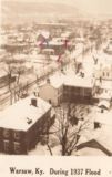
Warsaw in the 1937 Flood |
Note the old Bogardus Furniture Factory at the top of the image. |
 |
 |
1937 Flood in Warsaw
 |
 |
Betty (left) and Ruth Dickerson, at the 1937 flood
Betty's at Main Cross and High Street; not sure where Ruth's standing
Thanks to Dale Samuel for these two
 |
 |
 |
| Under the Hill in 1937 | Warsaw in the '37 Flood | Aftermath of the 1937 Flood |
 |
 |
| Just west of Warsaw | Just east of Warsaw |
 |
 |
 |
3rd Street, and the old Baptist Church
Ferry Landing with Ferry, 1937
The 1937 Flood covered Sparta Pike, south of Warsaw
You're looking south on Sparta Pike, near Bea Scott Street.
 |
 |
Just west of Warsaw
We think of it as Melanie Bledsoe's home.
Around 1970, Zack Bledsoe told us that on a hot
day the heat would still bring out the high water marks on the bricks, from the '37 flood.
In any flood, water is of course very destructive, but it will recede.
The problem is that when it does, there's mud. Which turns to dust.
![]()
| This boring picture explains a lot. You're looking west on US 42 in the '37 Flood, but that background tower is where many of the photo's below were taken, and how we know where they were. The tower belonged to an airport that used to be southwest of Warsaw - more of a glorified landing strip than what's normally thought of as an airport today. (But they had big expectations at one time) However, there was a government sponsored, war related effort to have a mail line between Louisville and Lunken, in Cincinnati. Warsaw is on an absolute straight line between the two. (their map's here) There was also an airstrip in Edgewood, and at Beacon Light just east of Beaverlick on US 42. (That's why they called it Beacon Light - because of the light that was on the tower to guide aircraft.) |
![]()
| That's John Heier down by the skiff, and Pryor Perry in the black coat. Perry was in charge of the Red Cross relief commodities. The photo was taken by Alfa Osborne. |
 |
 |
 |
 |
At Main Cross
The roof in the distance - almost underwater - is a two story building,
and at least two houses are floating.
That's W. R. Payne in the picture on the left. The building on the left is
the old Gallatin
County Deposit Bank. The fenced-in area behind it is a tennis court.
David Webb sent me this information on
the image on the left.
We believe this is 2nd Street, but that's a guess
We're pretty sure it's Warsaw & pretty sure it's 1937.
Beyond that, we're open to your thoughts.
How much greater was the '37 flood than its predecessors? Lots.
![]()
| A 1937 flood article says 31 Gallatin homes were washed downstream, here. | Dr. Carl Bogardus wrote this about the 1937 Flood. (pdf) |
| The Enquirer ran a story a week after the crest of the 1937 flood describing the effects along the river in Gallatin, Carroll and Trimble, which you can read here. | |
![]()
Near the Carroll County line, 1964.
Bill Davis tells us that this one originally ran in Life Magazine - with the image reversed.
 |
| Gex School, after the 1937 after the flood. It was located southwest of the corner of US 42 and T. Wilson Road at the eastern edge of the Gallatin Steel complex. From a Facebook post by Bill Davis |
 |
 |
| Florence , Indiana, 1937 | Patriot, Indiana, 1937 |
| Both from the Facebook page of the Switzerland County Historical Society | |
![]()


