
 |
 |
 |
||
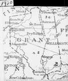
| Grant County formed from Pendleton, 1820. | Grant acquires small piece from Harrison, 1827. | Grant gains tiny section of Kenton, 1852. | ||
 |
 |
 |
||
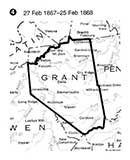
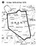
| Northwest corner goes to Gallatin, 1867. | Northwest corner comes back from Gallatin, 1878 | Grant gains a piece of Owen, 1876. | ||
| Changes in the Grant County Boundaries over the years. Not mapped is an 1862 change to accommodate local property owners, and an 1870 gain from Boone County. Additionally, there was an 1825 survey to clarify and define the county line between Owen and Grant. We also found a small piece conveyed to Grant from Campbell in 1831, before Kenton was created from Campbell in 1840. | ||||
 |
 |
 |
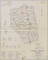
| Grant County, 1889 (Why's the northwest corner missing? Here.) |
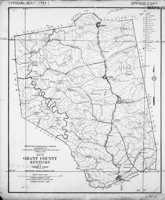
Grant County, 1935 Red lines are roads, black lines are railroads. |
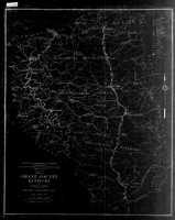
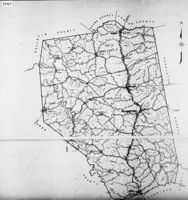
Magisterial District Map, 1940 |
 |
 |
| Crittenden | The Wells |
| These two maps are from Lloyd Franks' remarkable History of Crittenden (pdf). The Wells was an area just south of Crittenden, at one time a separate place. Read Frank's piece for all the details. | |
 |
 |
| These detailed maps of Williamstown from 1916 are Sanborn Fire Maps, originally created to assist insurance companies assess risk for underwriting fire insurance, hence “fire maps.” These we've downloaded from the Library of Congress' site for Sanborns. There are other sets of Williamstown, from other years, we didn't download, but which you can. | |

Matthew Souther has created an interactive map on Google of places of historical interest in Grant County.

This is a Southern Railway map from 1922. It's not to scale. Note how what was then the Lexington Turnpike bobs and weaves across the railroad. To see the full set of maps, from Ludlow to Lexington, they're at the bottom of our maps page. |
 |
 |
 |
 |
| 1890 | 1900 | Confusingly, this 1928 map says it was used for the 1900 Census |
|
 |
 |
 |
| 1925 map for 1930 Census | 1940 Census; undated map | 1950 is dated 1942. Note small insets |
|
| These six maps are enumeration maps from the US Census Bureau, used to delineate sections for which census takers were to cover. | |||
![]()
 |
 |
|
| Northwest Corner (1950) | Crittenden (1950) | |
 |
 |
 |
| Jonesville (1950) | Elliston (1950) | Williamstown (1950) |
 |
 |
 |
| Concord (1950) | Lawrenceville (1950) | Mason (1950) |
 |
 |
|
| Southwestern Tip | Corinth (1953) |
![]()
 |
 |
 |
| This is a geologic map of Grant County from 1925. Note the one-room school locations | Robert Rennick drew this map to identify many of the locations of US Post Offices over the years in Grant County. | Geologic Map, 1931 |
![]()