 |
|
|
| The Old Stone Bridge at Sandfordtown, a sketch by E. T. Hurley. Accompanying text is here. |
I-275 Construction in
|
Holy Guardian Angel School, Sandfordtown,
|
The 1881 dedication of Holy Guardian.
 |
| Chisel Bridge, just south of Sandfordtown. Site of LOTS of automobile wrecks. From a Facebook post by Dennis Kendall |
Sandfordtown token from John Haubner's Farmers Exchange
from a Facebook post by Edwin Morris
| Bud Deters wrote this piece about Morgan's Raiders in Sandfordtown in the Civil War. We advise double checking some of the facts. |
![]()
 |
 |
|
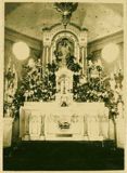
| Sandfordtown, and Holy Guardian Church and School. That's the altar on the right. (On Rt. 17, that's Dudley going left at the church.) Altar image from a Facebook post by Connie Mathews Martin |
||
| Holy Guardian interrupted by a nut case. | ||
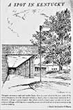
This Caroline Williams sketch is on “Hand Road.”
We assume they meant Hand's Pike
 |
 |
Cherokee Acres, just getting rolling, early 1960's |
Cherokee Shopping Center, 1975 From a Facebook post by Jerad Moore |
 |
 |
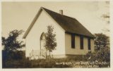
| New Banklick Baptist Church | |
“The picnic at Banklick Saturday was not so extensively attended as it might have been, but likely never will be surpassed for genuine jollity, polished hopping, and restrained rural rooster pluck.” From Covington"s Daily Commonwealth, July 24, 1879 |
There's a plan to control Banklick Creek flooding. From 1970. Here.
Flooding is an issue on Banklick. In 1931. Here.
Bank Lick Pike formally established in 1839. Here.
Banklick Creek, 1920's
In the April, 2022 issue of Kentucky Magazine, Randy Ogden writes about Old Dead Horse Creek, the name of which comes from a Civil War episode. It seems some confederate soldiers had stolen too many horses to make a successful escape, so they kept the best ones, and took the hides from the remainder. As we understand his description, the creek flows east into Banklick, south of Wayman's Branch and north of Thompson Creek (which flows along Fowler Creek Road). |
 |
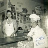 |
| Miller's Grocery, Nicholson | |
This map from 1865 shows a town at Nicholson's location, but the place is named California. |
 |
 |
|
| Dr. H. C. Nicholson's Quadruplex Telegraph patents | ||
Nicholson's most famous citizen is Dr. Henry C. Nicholson, who gave up medicine in favor of electrical engineering, and received a patent for a quadruplex telegraph, above, which enable four separate messages to go over the same wire at the same time. We located his obituary, and Bill Schmiade located more info about him. Nicholson's obituary. |
| “Kenton-co wool growers may make deliveries Monday and Tuesday at Nicholson, Ky., 2 1/2 miles from Independence, S. W. Durr, president, and W. Haden Ware secretary of the Kenton County Wool Growers Association announced Wednesday. A licensed U. S. grader will be furnished for the Wool Growers Association members.” Kentucky Post, June 14, 1933 |
Latonia Lakes isn't in Latonia. It's in Taylor Mill.
Bob Webster has written about it's background at this site (pdf).
![]()
 |
|
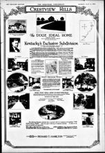
| Crestview Hills Kentucky Post, May 17, 1925 |
Crestview Hills, July 6, 1924 |
![]()
 |
 |
| The Woodland Inn, south of Walton Thanks to R. J. Yoder for these two images. |
|
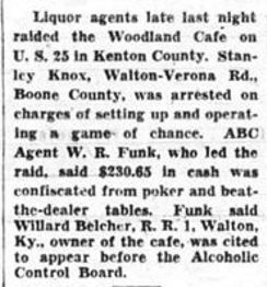
Kentucky Enquirer, January 6, 1952
 |
 |
Bracht Depot |
Bracht Depot, September, 1911 |
“The general dry goods store here of the
R. H. Stansifer Co., at Bracht's Station . . . was robbed
Sunday of dry goods, etc., to the extent of about $700. Elmer Stansifer
went to Newport for bloodhounds.” from Maysville's Daily Public Ledger, February 25, 1896
Bracht was named for Grant County's Major F. M. Bracht.
Man shoots four in an 1898 shootout at a Bracht saloon, story here.
| Key West, 1880's | Key West is just south of Bracht |
Railroad Section House in Bracht
21 miles to Ludlow, 314 to Chattanooga
 |
 |
| Shamrock Inn From a Facebook post by Wayne Carlisle |
Shamrock Inn From a Facebook post by John Engelman |
| Read Wayne Carlisle's post that went with this picture here. The Shamrock had a separate door, and a separate area inside for African-Americans. It was, for its day, a progressive step. The Inn burned in 2012. | |
![]()
 |
 |
| Piner Baptist Church | Piner Couple. Details |
| In 1854, Piner's Cross Roads claimed a school, a church, a cigar factory, and a blacksmith shop, and shared a post office with Fiskburg. The Fisk family, from Maine, began settling in the area in the 1820's. | |
Piner has a big shootout/robbery in 1931. A month later, another robbery.
| Experts say there's a giant oil field between Bracht and Crittenden. | |
| “The application of S. S. Mullins to keep a tavern at Key West, Ky., was granted yesterday by Judge Shine. There was a protest against it, but the Judge decided that the other crowd was the largest.” Cincinnati Enquirer, July 28, 1894 | |
| The Bracht-Piner Road was opened on December 18, 1926 and was described as the first road to connect “the eastern and western portions” of the Dixie Highway. The Covington Auto Club even debated which side was shortest. The resolution is here. | |
Piner High School was dedicated on Sept. 27, 1914. It was a frame building, and contained four classrooms and two halls, and was “beautifully situated on the Independence Pike.” |
Kentucky Governor Ruby Laffoon spoke at Piner High School in 1933 to a crowd of 250. |
![]()
“Kentucky's largest meteorite was found
in Kenton County in August, 1889, on a farm
eight miles from Independence by George Cornelius. It weighed 360
pounds.”
Louisville Courier Journal, September 1, 1940
 |
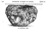 |
| On the left is a page from William D. Ehmann's Space Visitors in Kentucky: Meteorites and Meteorite Impact Sites in Kentucky on the Independence meteorite. More about the one that hit Williamstown is here, or you can find the entire publication on line here. It's a 53 page long pdf. The drawing on the right is from the Rochester Academy of Science, which acquired it. | |
![]()
Spring Lake, burned down in 1969
From a Facebook post by
Tricia Shawn Gibbons
The Spring Lake community was east of Decoursey Road, near the south end of the L&N DeCoursey railroad yards. The area was called Grant's Bend until roughly 1899, and there was discussion in 1906 to build a horse racing track there to compete with Latonia. There's a picture of the Spring Lake Elementary School, below. |
“Last night, James Bass, a farmer living at Spring Lake, just seven miles from Covington, received a visit from the Night Riders, who told him that he should cease growing tobacco or suffer the consequences.” Kentucky Post, April 18, 1908. The threat is an episode in the 1908 Tobacco Wars in Kentucky. |
 |
|
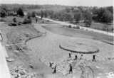
| Dixie Heights High School, final construction, Spring, 1936 from a Facebook post by Nate Thamann |
Dixie's front drive being constructed, 1938. From a Facebook post by James Russell |
 |
 |
|
| Dixie's stadium is named for former football/basketball coach & athletic director J. Rice Mountjoy, and the field is named for Bill Shannon, who was Mountjoy's successor in all three of those roles. | ||
| Dixie Heights & Its Elementary Schools, 1948 | ||
 |
 |
|
| Spring Lake |
Dixie Heights |
Bromley |
| The architect of the Dixie Heights building was Howard McClory. |
||
 |
 |
 |
| Forest Hills |
Park Hills | Crescent Springs |
The history of Crestview Hills is at the city's website.
Another is at the Northern Kentucky Magazine's site.
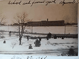
Edgewood's Hinsdale School
 |
 |
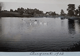
| Wilde Lake, south of Dixie, between Beech and Lyndale Road. From a Facebook post by Susan Wilde Chase | |
 |
 |
|
Schools Busses at Dixie, 1948 |
Edgewood / Erlanger Aerial |
Dixie Heights Fishing and Hunting Club, 1946 |
![]()
| Taylor Mill gets a new elementary school for it's 460 pupils. | |||
![]()
 |
 |
|
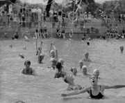
| Pleasure Isle, 1936 Thanks to Dale Ashcraft for this one. Photo by Emma Hahn Ashcraft |
Pleasure Isle From a Facebook post by Arlina Lag |
Read Deborah Kremer's feature on Pleasure Isle here.
The Log Cabin, across from Pleasure Isle, was once a toll gate.
 |
 |
 |
 |
 |
Pleasure Isle, West of the creek at Rt. 17 and Hand's Pike
from Facebook posts by Darlene Klein Bunch, whose grandfather managed Pleasure Isle.
![]()
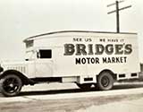
The Huckster wagon of Lloyd and Holbert Bridges operated in southern Kenton in the 1930's.
from a Facebook post by Joseph Harvey, a grandson and great nephew of the Bridges
Wilmington Baptist, Fiskburg
Taken at it's dedication, August, 1953.
Read the story here. (pdf)
This little church can trace its roots
back to 1804! How old is 1804?
Try here.
| Wilmington established in 1793, in what is now Kenton County. | “John Grant was the 1st white man who settled in the territory we now know as Kenton County. His settlement was made on Licking River some 13 miles from its mouth. The place was afterwards dignified with the name of Wilmington, and there the 1st court for Campbell County, then including all this region, was held.” the Paris, Ky. Western Citizen, March 21, 1851, in the Draper Papers, 11CC48 | |
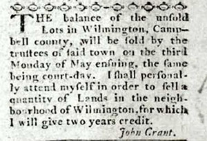
Kentucky Gazette, January 31, 1795
![]()
The Fiskburg-Covington Bus, a 1914 International Harvester
 |
|
| M. H. Frost Store, Fiskburg | The Fiskburg Garage |
“Fiskburg is located on the Independence and Colesmanville [Harrison County] pike, 21 miles from Covington, and six miles from Morning View. We have a post office, school, church, blacksmith shop, one store, cigar factory, toll gate, doctor and preachers. We also have a Grange, Temple of Honor, and a Masonic Hall. We want and must have a pike from here to Morning View [where the railroad is]. The sooner the better.” from the Newport Local, September 5, 1878. |
![]()
“Key Hole. This village is situated between Kenton Heights and Greenwood, on the
Southern Railroad. The inhabitants are fisherman, loungers, and stem winders.” from Covington's Daily Commonwealth, March 13, 1879
![]()
 |
 |
| Hartke Dairy Farm, 1929, before it became Summit Hills from Facebook post by Chuck Eilerman |
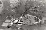
Aerial View of Summit Hills Country Club |
 |
 |
 |
Thomas More Foundation |
A still earlier view of |
Thomas More |
President Lyndon Baines Johnson was on hand for the Thomas More Dedication, and referred to his Kentucky ancestors. That sent Northern Kentucky historian Chester Geaslen to check out the connection. |
||
Lawsuit over repair of Taylor's Mill Bridge, here.
 |
| Northern Kentucky Health Occupations 790 Thomas More Parkway |
![]()
| Kenton County Tavern Rates, | 1883 |
| Meals, each | 40 cts |
| Lodging | 40 cts |
| Common whiskey, per drink | 05 cts |
| All Other Whiskey, per drink | 10 cts |
| Brandy, rum, gin, wine, etc | 15 cts |
| Grain or feed, per gallon | 25 cts |
| Horses, per night, hay or grain | 40 cts |
| Pasturage, per day | 10 cts |
From the Covington Daily Commonwealth, April 24, 1883
| Atwood was named for Atwood Bird, a bank president in Independence whose grandfather came to the place now known as Atwood in 1813. Fiskburg was named for one Dr. Fisk; Nicholson was named for Dr. H. C. Nicholson, father of the noted builder George Nicholson; Piner , at one time Piner Crossroads, was named for Brack Piner, a storekeeper there, after the name Goshen was disallowed; and Whites Tower was named for one George White, who farmed 300 acres in that area. | |
| White's Tower is named for a large white tower that stood there, and was torn down in the 1920's. We're sure somebody out there has a picture of it, but it has not to date surfaced. | |
| “A Temperance Reform Club was organized at Staffordsville, Kenton county, Kentucky, on last Sunday. An able address on the subject of temperance was delivered by General John W. Finnell, and twenty-five persons were induced to pledge themselves to total abstinence from all intoxicating liquors.” Courier-Journal, June 10, 1869 |
![]()
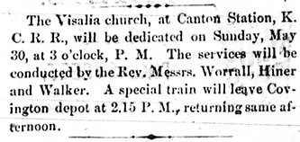
Covington Journal, March 22, 1869
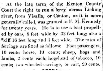
Covington Journal, March 5, 1870
| “In the County Court, yesterday, Thomas F. Holmes was granted the privilege of running a ferry for five years across the Licking river at the road leading from Independence to Alexandria.” The Daily Commonwealth, September 28, 1880. | Deed restrictions that can seem reasonable in some decades, can be way beyond quaint as time passes. Check out this deed restriction from a 1881 mortgage in Visalia. |
| Fire from lightening hits Visalia in 1882. Story's here. | In 1835, the mail route for Visalia was “From Barry, by Visalia, Alexandria, Carthage, Flagg Springs, to Point Pleasant, Ohio, 25 miles, and back, once a week.” from the Kentucky Gazette, August 29, 1835 |
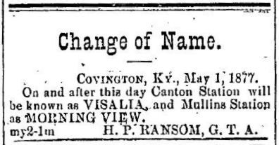
| The naming of Visalia, here. | |
| Crime spree in Visalia, here. | |
| Visalia incorporates as a city. Read the 1869 act is here. | |
A pair of short items about Visalia from 1878 are here. |
Historic Visalia property changes hands in 1934, more here. |
| “A new sect of Baptists, called the Berean, has organized a church at Visalia, on the K. C. [Kentucky Central]. It is the only one in the State and their particular belief is that while the righteous enjoy eternal bliss, the wicked merely perish out of existence, there being no hereafter with them. They believe in the special providence of God, and are in number at that place of about 50.” from Standford, Ky.'s Semi-Weekly Interior Journal, June 29, 1886 | |
General John Finnell's 1880 Raspberry Festival in Visalia, here. Finnell's Grove was a popular amusement venue of the time. St. Patricks held a fund raising picnic there on June 25, 1871, the Brotherhood of Locomotive Engineers held their annual picnic there on June 28, 1873, and the Merry Young Bachelors of Canton Station gave a picnic there on August 5, 1871. |
|
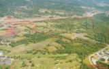
 |
 |
| Announcement from Covington's The Ticket, May 3, 1877 | The Catholic Telegraph, September 17, 1908 |
Thieves try to derail a train near Visalia. Story's here.
“At the late term of the Kenton County Court the right to run a ferry across Licking river from Visalia, or Canton, as it is more generally called, was granted to F. M. Kennedy for twenty years. He is to use a boat propelled by oars, 8 feet wide and 32 feet long, also a skiff 16 feet long and 4 feet wide. The rates of ferriage are fixed as follows: Foot passengers, 10 cents; horse 10 cents; sheep, hogs, and lambs, 2 cents each; hogsheads of tobacco, 10 cents; two wheeled carriage, or cart, 20 cents.” from the Covington Journal, March 5, 1870. |

The Daily Commonwealth, September 28, 1880
![]()
In the 1870's the Covington's Commonwealth, later the Daily Commonwealth, published any number
of letters from
correspondents from various communities in Kenton County.
Some of the names may well have existed solely in the contributor's mind. Everybody knows about
Piner and Atwood and Nicholson, but how
are you on these? |
Pickettsville. “This is a beautiful village, situated about one mile south of
Stewartsville, and about two miles west of Benton Station
[Kenton]. It consists of a blacksmith shop, one wagon-maker's
shop, a tobacco warehouse, and |
| Websters Grove. “Some will wonder where “Websters Grove” is. And we will try and give a description. This beautiful grove lies about 2 miles west of Benton, 2 miles east of the Colemansville pike, 3 miles north of Point Lookout, 2 miles south of Staffordsburg. I could say much more of this grove, with its delightful breezes in the summer, but as I fear I have wearied you already, I will desist.” from Covington"s Daily Commonwealth, March 19, 1879 |
| There were two places in Kenton County which had post offices whose locations are not known: Cloyd's Cross Roads, which had a PO from 1830-1835; and Sayers', which had a PO from 1832 to 1835. We note that Cruise's Creek has a tributary called Sayers' Creek. |
| Rouseville “This place is situated four miles south of Independence, on the Banklick Pike. There is one large dry goods store and grocery, one blacksmith shop, one wood shop, and several dwellings. Mr. Robert Rouse is building the largest tobacco barn in the county.” from Covington"s Daily Commonwealth, May 2, 1879 |
| Key Hole. “This village is situated between Kenton Heights and Greenwood, on the Southern Railroad. The inhabitants are fisherman, loungers, and stem winders.” from Covington"s Daily Commonwealth, March 13, 1879 |
Senours' Woods. “This place is situated six miles from Covington on the Dudley Pike, and is a quiet and peaceable neighborhood. The farmers are preparing for the spring, making rails and resetting fences.”from Covington"s Daily Commonwealth, February 26, 1879 |
| Goshen Ford. “Mr. Allen Northcut, a citizen of Kenton county, was attacked Monday night, near Goshen Ford, south of Independence, by six men who knocked him from his horse, and robbed him of about five hundred dollars.”Courier-Journal, August 12, 1869 |
Point Lookout. “This place is situated between Cruises Creek and Darby Hollow.” from Covington"s Daily Commonwealth, February 12, 1879 |
| We also find place names for Bowmansville, Shiloh, Oak Ridge, Morgansville, Susiedale, Proctor, Stewartsville, and Stephen's Store |
The Minutes for the Miami Association of Baptists, in 1850,
refer to the Salem Association, at “Crewscreek Church, Kenton Co., Ky.”
Madison Pike, painting by Godfrey Frankenstein, c. 1851
Looking North, from what was an old Sanford house, in 2022, the Noah's Ark Animal Clinic
From a Facebook post by Paul Saint-Villiers
Bank Lick Valley, Kentucky 1869
Painting by Godfrey Frankenstein
| This item says General John Hunt Morgan was in Sandfordtown. We have doubts. | |
| This item says General LaFayette visited on Richardson Road. We have doubts. | |
George C. Weidner's profile of Edgewood is here. (pdf) |
Crestview Hills has its history on line here. |
![]()


